


Welcome to Skagit County
July 16th, 2007
SKAGIT COUNTY GIS DEPARTMENT RECEIVES HONORS FOR EXCEPTIONAL WORK USING GIS TECHNOLOGY
San Diego, California—The movie industry has the Academy Awards; theater has the Tony's; and the GIS community has the Special Achievement in GIS (SAG) Awards. On June 20, 2007, the Skagit County GIS Department was recognized for excellence in the Geographic Information System (GIS) field with a 2007 Special Achievement in GIS (SAG) award at the Twenty-sixth Annual ESRI International User Conference in San Diego, California. ESRI, the world leader in GIS software, presents the award to organizations and agencies that display dedication and commitment through their use of GIS technology. The winners of the award are chosen out of more than 150,000 organizations worldwide.
“The SAG awards celebrate the achievement and vision of innovators in the GIS field,” says Jack Dangermond, ESRI president. “Each winner brings benefits to their communities and influences others to do the same. To make a successful system takes a lot of work," he said. "Someone starts with an idea and it has to be sold and designed. You have to figure out what is needed and get management support.”
A GIS is a collection of computer hardware, software, and geographic data for capturing, managing, analyzing, and displaying all forms of geographically referenced information. With a GIS, users can link information to location data such as people to addresses, buildings to parcels, or streets within a network. This innovative technology enables users to create layers of information and present a visual representation for analysis that leads to more informed decisions and a better understanding of their communities, businesses, and the environment.
Skagit County GIS is a leader in Washington State in using GIS technology to benefit the community. County government departments use the technology to manage vital information about the area, including property information, emergency services, community development, and much more. Aside from internal use, the GIS Department reaches out to the community by providing an online GIS application that enables citizens to look up property assessments from their homes or track crime trends in their neighborhoods. They also work with other agencies to provide GIS support and cost sharing partnerships.
“This is the biggest award we can achieve in our field of expertise”, says Geoff Almvig, Skagit County GIS Manager. “We are fortunate that we have leaders who support us and a hard working Information Technology Department who keeps our computers running and provides us with exceptional computer support.”
Some of the other organizations being honored at the 2007 User Conference include
Water Supplies Department, Hong Kong SAR Government; USDA Forest Service; Harvard
University; Bureau of Environmental Sciences and Engineering; Best Buy Corporation;
Alaska Department of Fish & Game; United Nations Environment Programme –
World Conservation Monitoring Centre, United Kingdom; City of Oslo, Norway;
Georgia Department of Transportation; and The California Academy of Sciences.
For more information about Skagit County GIS and the iMap and Crime Map products, go to the Skagit County web site at www.skagitcounty.net.
About ESRI
Founded in 1969, ESRI is the leading developer of GIS software with more than 300,000 clients worldwide. ESRI software is used in all 200 of the largest cities in the United States and in more than 60 percent of counties and municipalities nationwide. Headquartered in California, ESRI has regional offices throughout the United States, international distributors in more than 90 countries, and more than 1,700 business partners. ESRI’s goal is to develop comprehensive tools that enable users to efficiently manage, use, and serve geographic information to make a difference in the world around them. ESRI also provides consulting, implementation, and technical support services. ESRI can be found on the Web at www.esri.com.
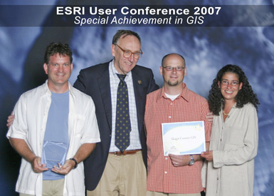
Skagit County GIS employees Geoff Almvig, Sean Carson, and Rachel Schwinden
receiving the award from ESRI President Jack Dangermond.