FLOOD ADVISORY DEFINITIONS
FLOOD
STAGE: A
site-specific river level at which flood damage may start to occur;
usually at or above the top of the riverbank. Flood heights are often measured relative
to the flood stage elevation . At the Concrete and Mount Vernon gauges, flood
stage is 28 feet.
FLOOD
WATCH: The
first of two basic advisories issued by the National Weather Service. A flood watch is issued when conditions are favorable for flooding. A watch does not mean that flooding
will definitely occur, but it does give a community an early notice
of potential flooding and allows the community to review flood safety
steps.
FLOOD
WARNING: The second
basic advisory issued by the National Weather Service. A flood warning is issued when flooding conditions are expected
to develop. In some cases, the food warning will
be river stage or height reading. The National Weather Service tries to issue flood forecasts
with an accuracy of plus or minus one foot. But there are many variables that
can enter into this forecast. Some of the variables are difficult to predict, yet have great
impacts on flood forecasts.
PHASE
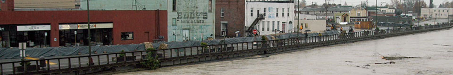
1 FLOODING: Phase 1 floods can cause catastrophic damage in the valley. A very large phase 1 flood would be considered a 100-year flood which means the probability of a flood of this magnitude would have approximately a 1% chance of occurring in any given year. The last Phase 1 flood occurred in November 2021 when the Skagit River reached a height of 38.93 feet on the flood gauge in Concrete, well above the Phase 1 criteria of 37 feet.
PHASE
2 FLOODING: Phase 2 floods inundate a wider area and may cause significant damage. Phase 2 flooding occurred in 2018, 2016, and 2015, when the Skagit River reached heights above 32 feet on the flood gauge in Concrete.
PHASE
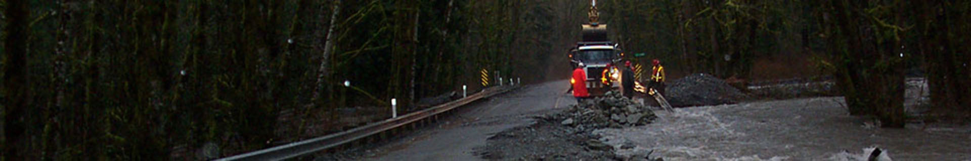
3 FLOODING: Phase 3 floods inundate low areas near the Skagit River, may cover sections of roads, and occur roughly every few years. They generally cause minimal damage in the Skagit River Valley.
100-YEAR FLOOD: A term used to define an extreme flow rate that has
a one percent chance of being exceeded in any given year. The 100-year
flood is a flood that is equaled or exceeded once every 100 years
on average. The term should not be taken literally as there is no
guarantee that the 100-year flood will occur within a 100-year period
or that it will not recur several times.
cfs: The rate of flow (see Discharge) past a given point, measured in cubic
feet per second. One cubic foot of water equals about 7 gallons.
DIKING DISTRICTS: These districts are given responsibility over the approximately
80 miles of dikes and levees in Skagit County. These districts can
assess those within the district that are receiving benefits as well
as petition the county, state, and federal government for funding
and assistance. Funds raised are used to construct and maintain dikes,
levees, tide gates, keyways, and bank stabilization. These districts
are administered by a board of commissioners which are elected but
do not receive a salary. If you would like Dike District information
please call Skagit County Surface Water Management at 416-1400.
FLOOD INSURANCE: The insurance coverage provided through the National
Flood Insurance Program.
Flood Insurance Rate Map (FIRM): An official
map of a community on which the Federal Emergency Management Agency
has delineated both the special hazard areas and the risk premium
zoned applicable to the community. FIRMs typically identify the elevation
of the one percent annual chance flood and the areas that would be
inundated by that level of flooding; they are used to determine flood
insurance rates and for floodplain management. FIRM maps are available
at the Skagit County Planning and Permit Center.
GAGE HEIGHTS AND PHASE
Skagit
River Gage near Concrete
This USGS gage is located near the community
of Concrete at river mile 54.1 on the Skagit River
Phase
1
37.0 to 48.8 |
Phase
2
32.0 to 37.0 |
Phase
3
28.0 to 32.0 |
Skagit
River Gage near Mount Vernon
This USGS gage is located at the Riverside bridge
on the main stem at river mile 17.0.
Phase
1
35.6 to 40.0+ |
Phase
2
32.0 to 35.6 |
Phase
3
28.0 to 32.0 |
Gage
heights are measured in feet.
|